How to Climb Katahdin: Elevation, Trails, Reservations & Safety Tips
Don’t miss the Frequently Asked Questions at the end!
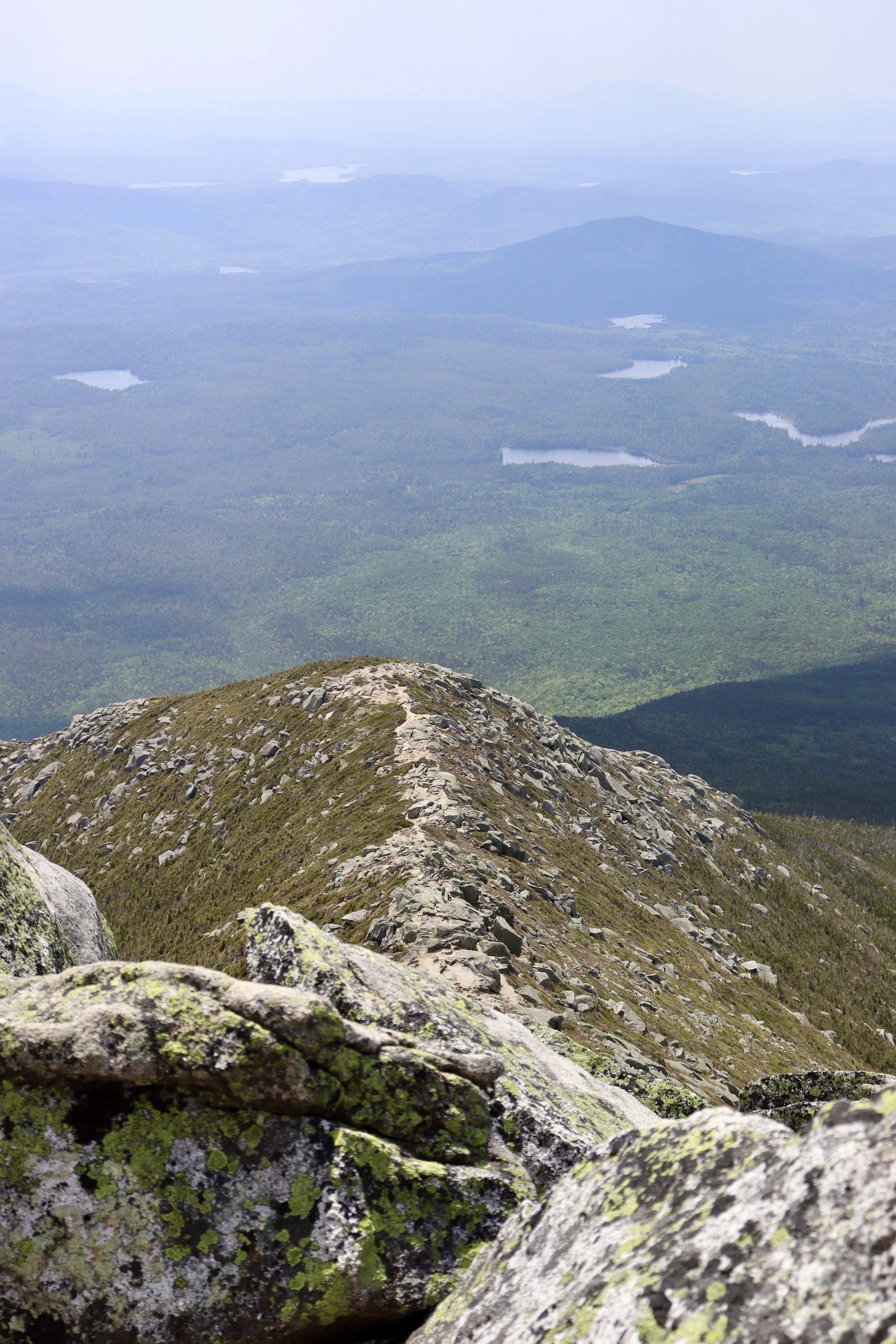
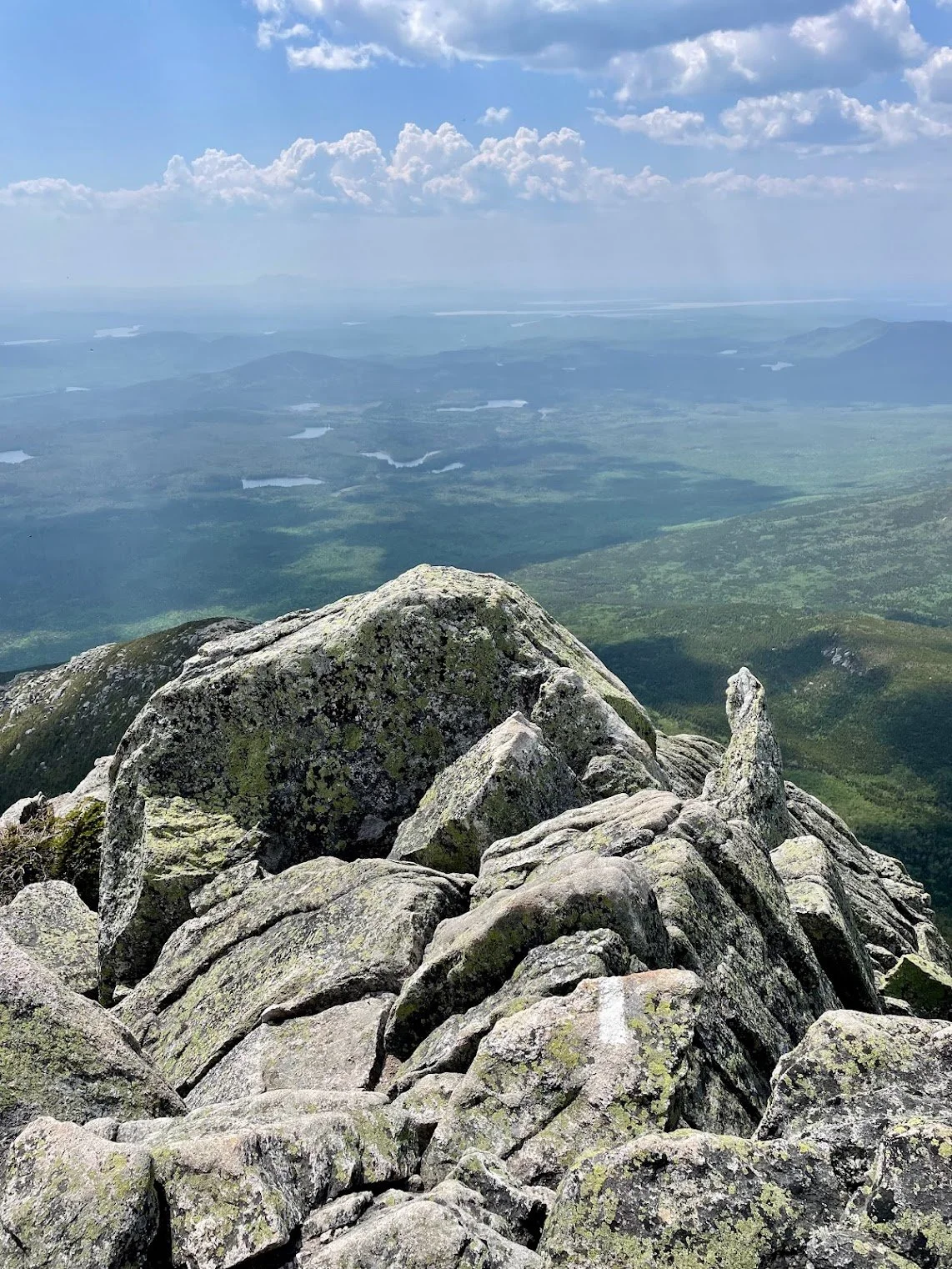
Hunt Trail from the top looking down.
The Mountain: aN oVERVIEW
At 5,269 feet tall, Mount Katahdin is the highest mountain in the state of Maine and the undisputed centerpiece of the 209,501-acre Baxter State Park. Katahdin has inspired worship, poetry, artwork, and adventure for generations; its highest summit, Baxter Peak, is the official northern terminus of the 14-state Appalachian Trail. It’s a rugged and extremely strenuous climb up from just about every angle, but you do have some options. Hope you’ve been hitting the stair stepper 😎.
Besides being one of my favorite hikes of all time, Katahdin is also the king of people-watching experiences (comment your most interesting hiking encounter at the end of the article!) Within thirty minutes of summiting, I met a man who was planning on doing the entire Appalachian Trail barefoot (he did have emergency flip-flops in his pack). After spending a few minutes pondering how tough I really was…I met an entire group of barefoot Anabaptist teenagers. Cool. I’m a wimp. Then there was the guy setting up a giant green antenna at the top. Gotta check for aliens when you can.
I mean, I’m sure I was dehydrated, but was I hallucinating? Probably.
Beyond the Hike: Cultural Meaning of K’taadn
This guide wouldn’t be complete without mentioning the history of the “Greatest Mountain,” which is what its name means in the Penobscot language. For the Penobscot people, Katahdin has long been a sacred place, tied to deep cultural stories and the spirit Pamola, a legendary protector said to dwell on its summit. Katahdin is a reminder that wild spaces carry stories older than our trails and summit selfies. We’re stepping into a landscape that has shaped cultures, inspired awe, and demanded respect for thousands of years. Please respect it.
sTEP 1: pLAN tHE rOUTE
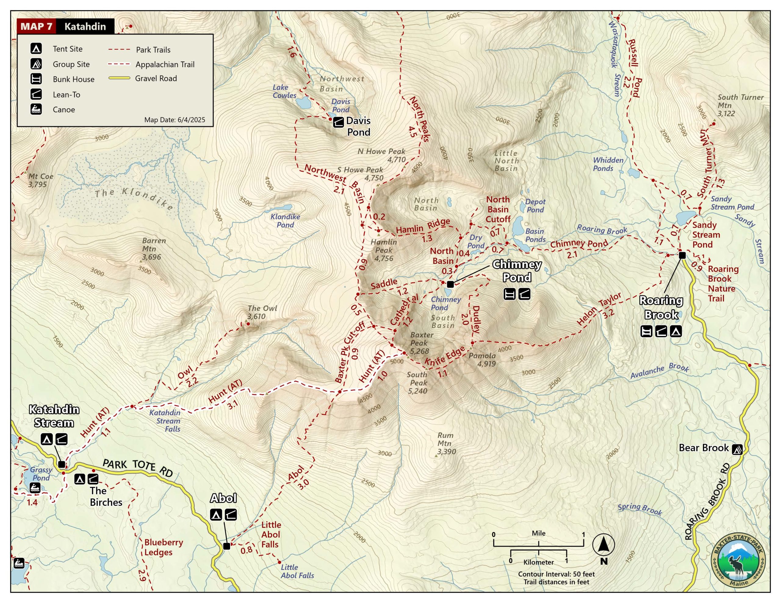
Our route! Total of 11.2 miles when you include the Park Tote Road, 9.2 of which are on-trail. To see this non-annotated map, check it out here.
It was early June when I climbed Katahdin for the first time. Initially, I had wanted to try my hand at the stunning, precarious Knife Edge Trail along the top, but it was still closed for snow. Instead, my boyfriend and I camped at Abol campground and took the Abol Trail up and the Hunt Trail down. I would highly recommend that route for a first-timer. It does spit you out for a two-mile dirt road walk at the end, but that will feel like walking on the moon after your summit experience.
Why We chose this route
Abol is sheer and steep near the top — better terrain to ascend — while Hunt feels like a warm hug (comparatively 😶) with an added bonus of beautiful boulder fields and waterfalls. Our total mileage came to 9.2 on the mountain plus the two road miles at the end, in addition to maybe an extra half-mile spent swatting the air and hiding from the swarms of insects that plagued us incessantly for twelve hours. If you’re planning to go in June, buy a head net and don’t take it off until you’re safely back in your car with the windows up. If it’s early June, you may even want to just go ahead and keep it on the whole drive home. Am I scaring you off? Good, because if I don’t, the black flies will carry you away into the darkness. 😂😅
Reality check: Katahdin is worth it despite any amount of bugs, and once you’re near timberline, the wind tends to keep them at bay regardless.
There are many ways to approach Katahdin; as always, your route of choice should depend on your goals. Here’s a quick summary of popular routes:
If you’d like to experience the climb as an Appalachian Trail thru-hiker might, you’ll want to take the Hunt Trail up.
If you want to instead channel Henry David Thoreau, who climbed the "stern, yet gentle, wildness” in 1846, take the Abol Trail to the top - although my bruised and battered body disagrees with him on the “gentle” part.
If you’re not afraid of heights and won’t be lugging a heavy pack, tiptoe gingerly along the Knife Edge or Cathedral Trails.
If you’re a backpacker and would like to come in from the north to complete a loop, there are routes around Russell Pond, the most remote campground in the park, too.
Regardless of your preferred route this time, be prepared for incredible, expansive views, a spiderweb of diverse trails, and a rare subarctic climate (one of only two found in Maine!) These are just a few of the laundry list of reasons that the legendary mountain is well worth the long haul to Baxter State Park.
Speaking of Knife’s Edge, summit Katahdin and eternalize your experience with this unbelievable print (or sticker) below!
sTEP 2a: cHOOSE YOUR CAMPSITE
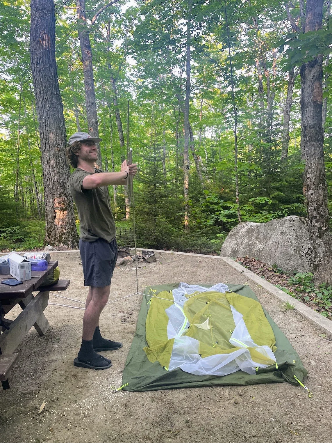
Getting cozy for the night at Abol Campground.
I’ll start this section by saying, I highly recommend camping at the trailhead. But if you can’t or don’t camp trailside, proceed to Step 2B below!
Because of its sheer size and intentionally (and charmingly) undeveloped infrastructure, Baxter State Park is a notoriously confusing recreation area for first-timers. So take my word for it and use the following three cheat codes sprinkled throughout this and the next section:
Cheat Code #1: There are three drive-up trailhead campgrounds within Baxter State Park that will put you right on the trails to the peak: the Katahdin Stream, Abol, and Roaring Brook campgrounds.
Conditions permitting, most campgrounds in the park open for the summer season on May 15 and close either October 15 or 22. You can also plan to camp in the backcountry Chimney Pond or Russell Pond campgrounds, although you’ll have to add some extra miles hiking to them from where you’ve parked, which will be either at Roaring Brook or South Branch Pond. Most of these campgrounds are extremely popular and fill up quickly during the short summer season, especially on the weekends.
Cheat Code #2: Campsite reservations are rolling and can be made four months in advance, so mark your calendars exactly four months in advance of when you want to go, and click refresh like a mad-man.
I would recommend calling the reservation office with any questions, as there are very strict rules and regulations across the park and you don’t want to risk being turned away at the gate.
Step 2B: BOOK YOUR PARKING
If you’d prefer a day-hike of Katahdin without any camping (or camping away from the trailhead) you have some options for that, too! If you are not camping in Baxter State Park the night prior to your hike and you’re starting from a trailhead campsite, it is highly recommended that you obtain a Katahdin Trailhead Pass (KTP) for your day on the mountain. This is essentially a parking reservation to ensure that you’ll have a spot. If you don’t purchase a KTP ahead of time, rangers will only let you into the park if the lots aren’t already full with campers and KTP folks - it’s a real gamble. Even if you do have a KTP, it expires if you are not lined up at the entrance gate by 7:00am on the day of your hike. Thankfully, no other campsites in the park require one.
Cheat Code #3: You can reserve a maximum of two KTPs per June-October season starting on April 1 by going online, calling, or utilizing snail mail for a wonderful old-school thrill.
Step 3: Get Packed
If you will be camping the night before, remember that you can pack up your camp in the morning and stash all unnecessary gear in your car - just bring what you need for the day plus what you might need in case of emergency. Travel with lots of water (at least two 24 oz. bottles per person) and a good water filter and fill up on your way up; water sources dwindle as you ascend. Don’t count on having any cell service in the park, so either download your maps onto your phone (with a charged charger) or print them out.
A headlamp, knife, first aid kit, head net, and jacket/space blanket, and rain poncho are essential. I would also recommend carrying a small backpacking stove to the summit, as it can be chilly at elevation and a hot lunch (soup!) will dramatically improve your spirits if you’re starting to crash. Baxter State Park has stringent requirements on what you can and can’t take into the park, so be sure to check first to avoid any ranger wrath. Finally, as always, have enough food and fuel to get you and your entire party safely back to civilization.
Check the FAQ section at the bottom for a bulleted list view of what’s in my pack!
Step 4: Hike
I’ll let this section speak for itself!
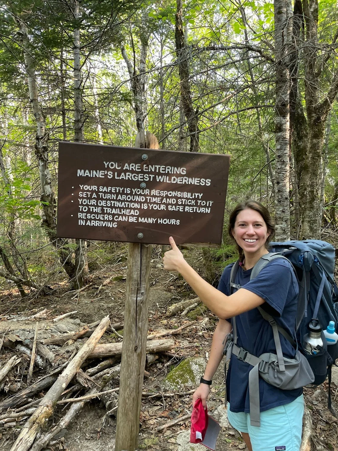
Enter at your own risk!
Not sweating on the Abol trail 😅
Abol’s blue trail blazes heading to the top.
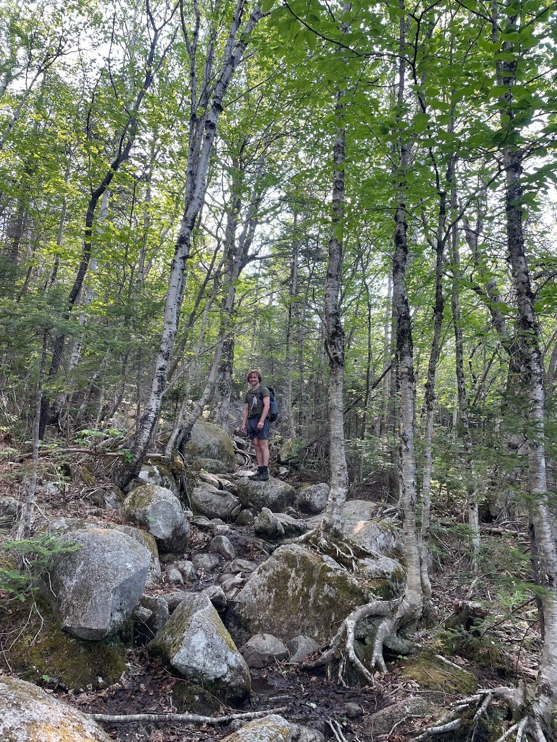
Abol below treeline on a gorgeous June day.
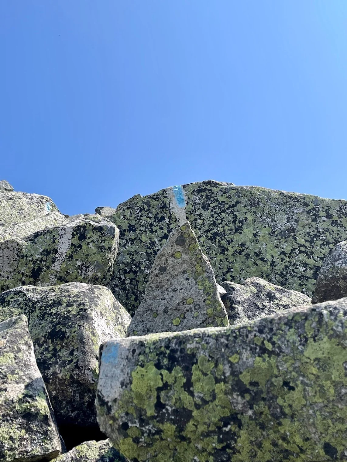
Can you find the white trail blaze in this photo?
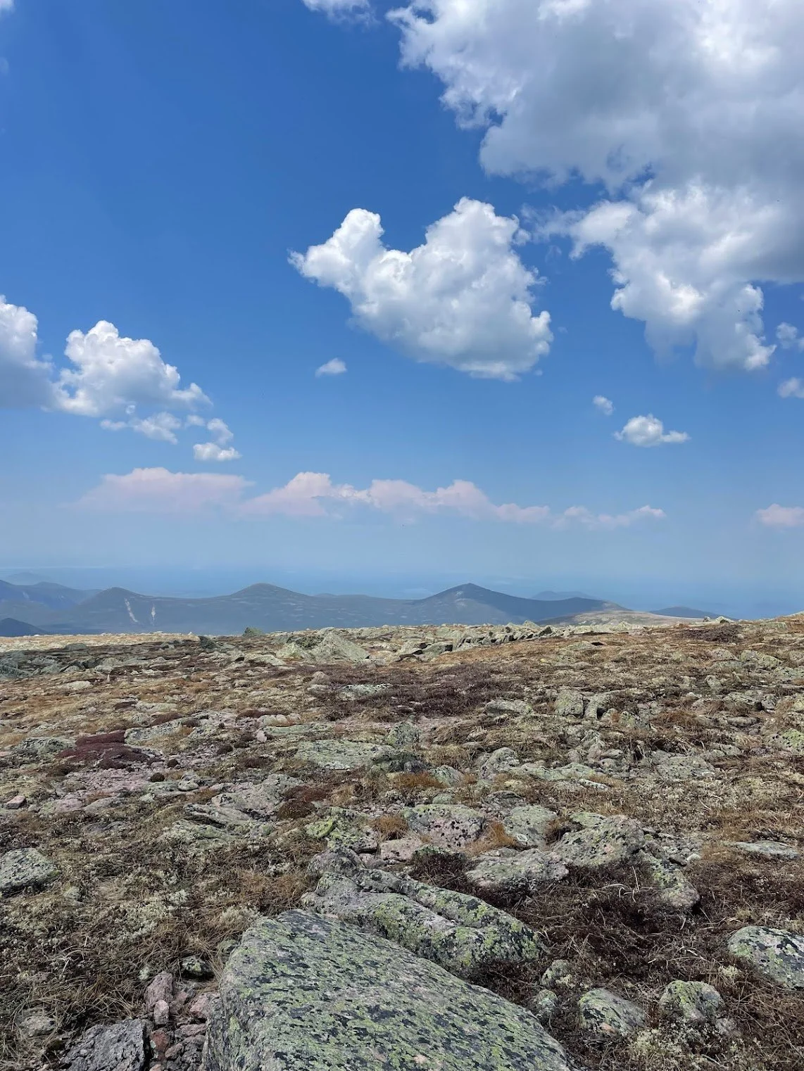
Katahdin and nearby Hamlin Peak are the only two areas to host a subarctic climate in Maine.
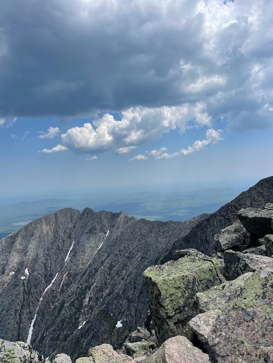
Snow lingering on the Knife Edge Trail in June.
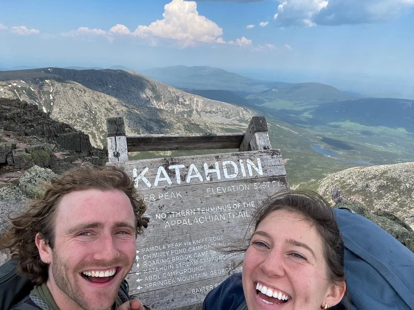
We made it!
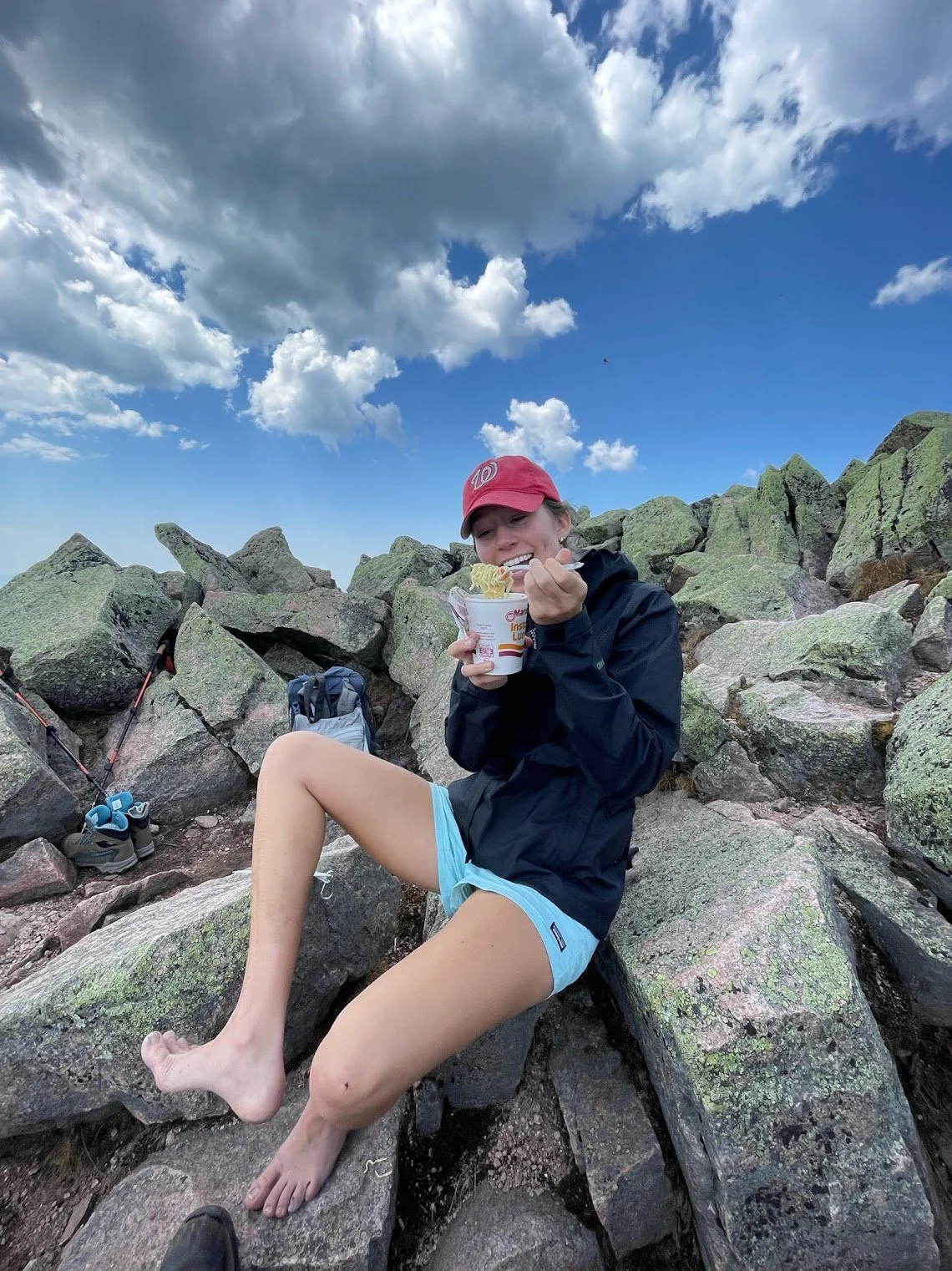
Boots off, soup’s on.
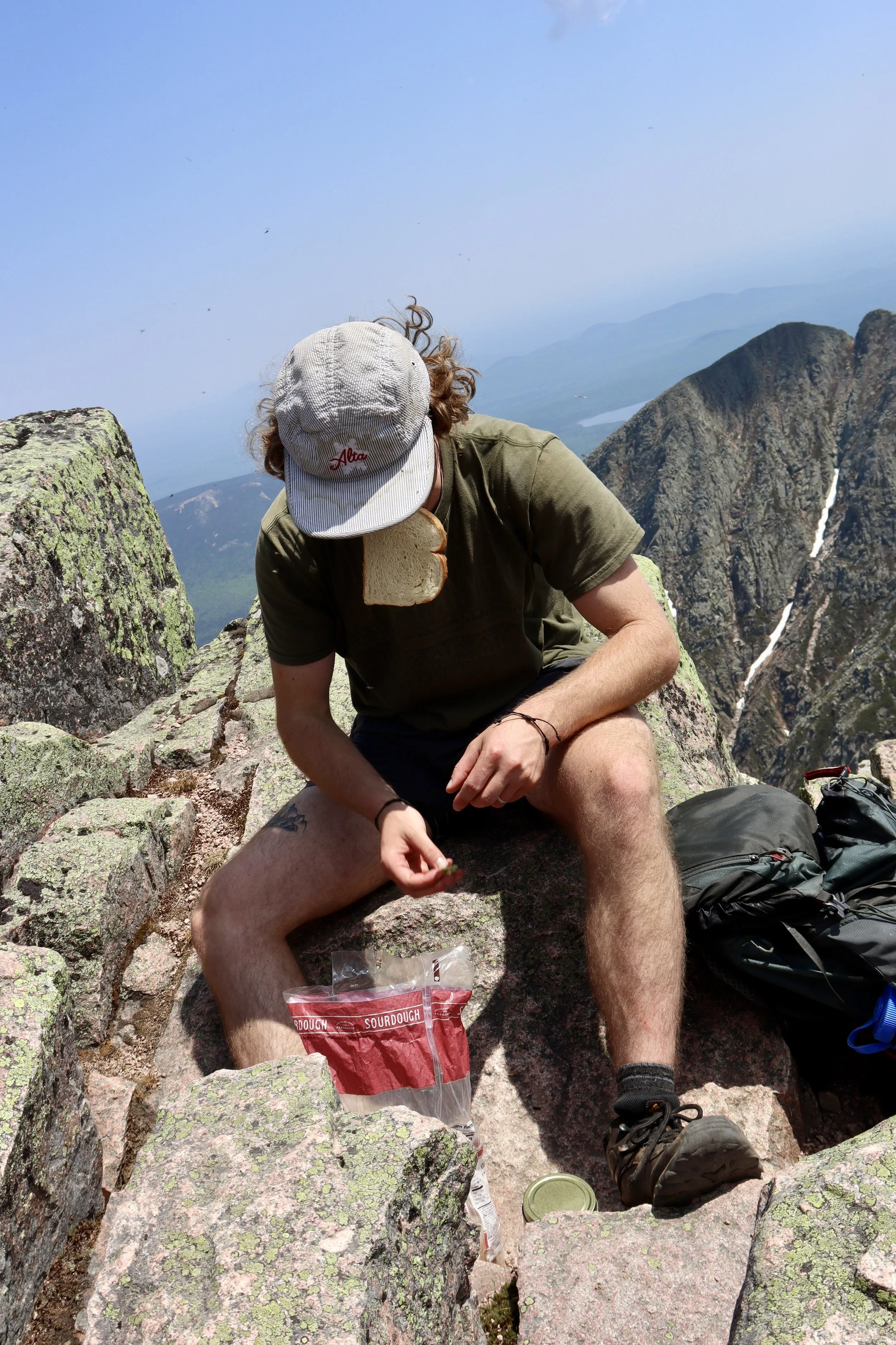
Nothing like plain sourdough at the summit.
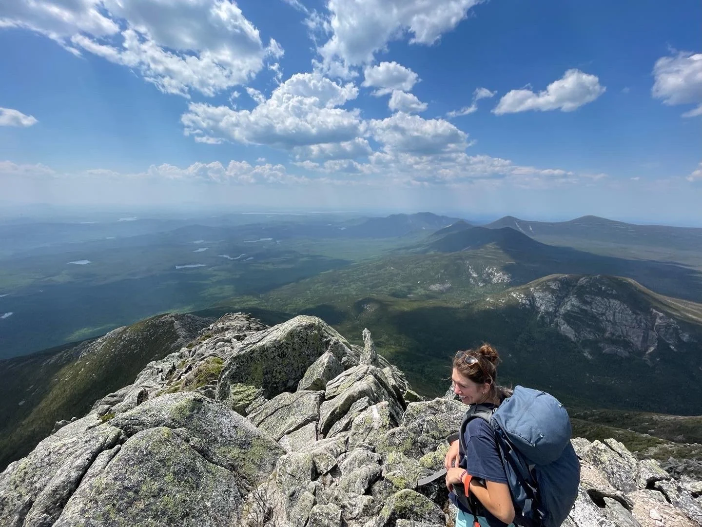
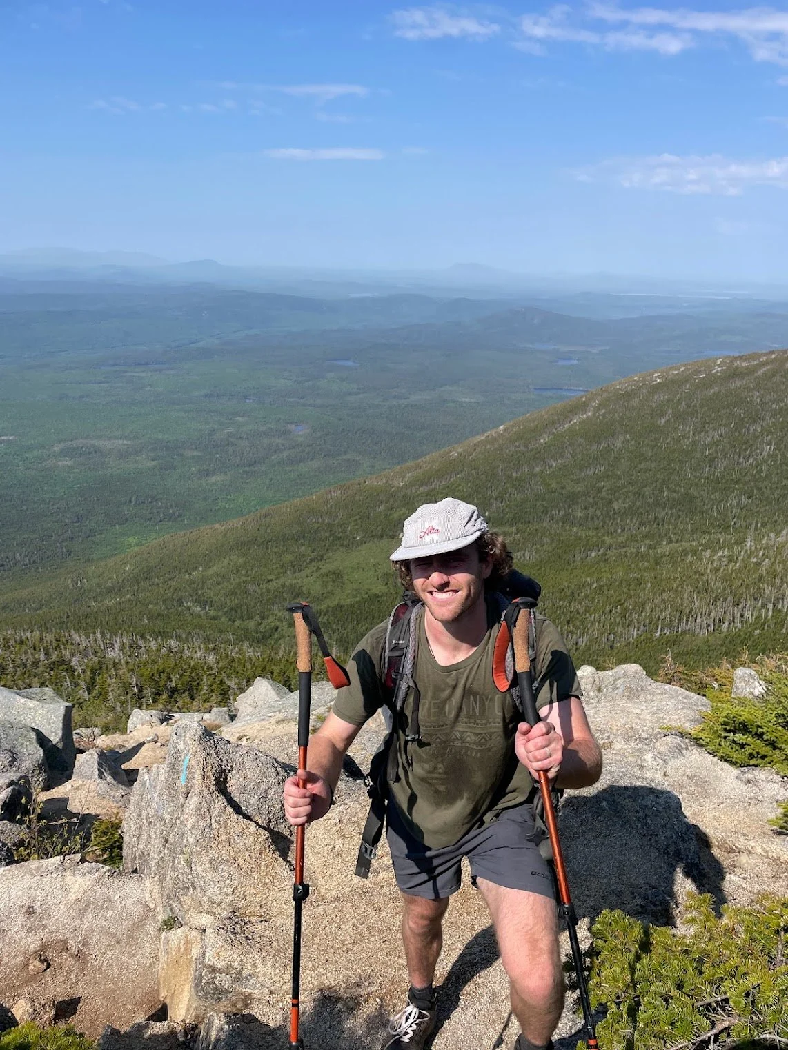
Stoked on the view from the top.
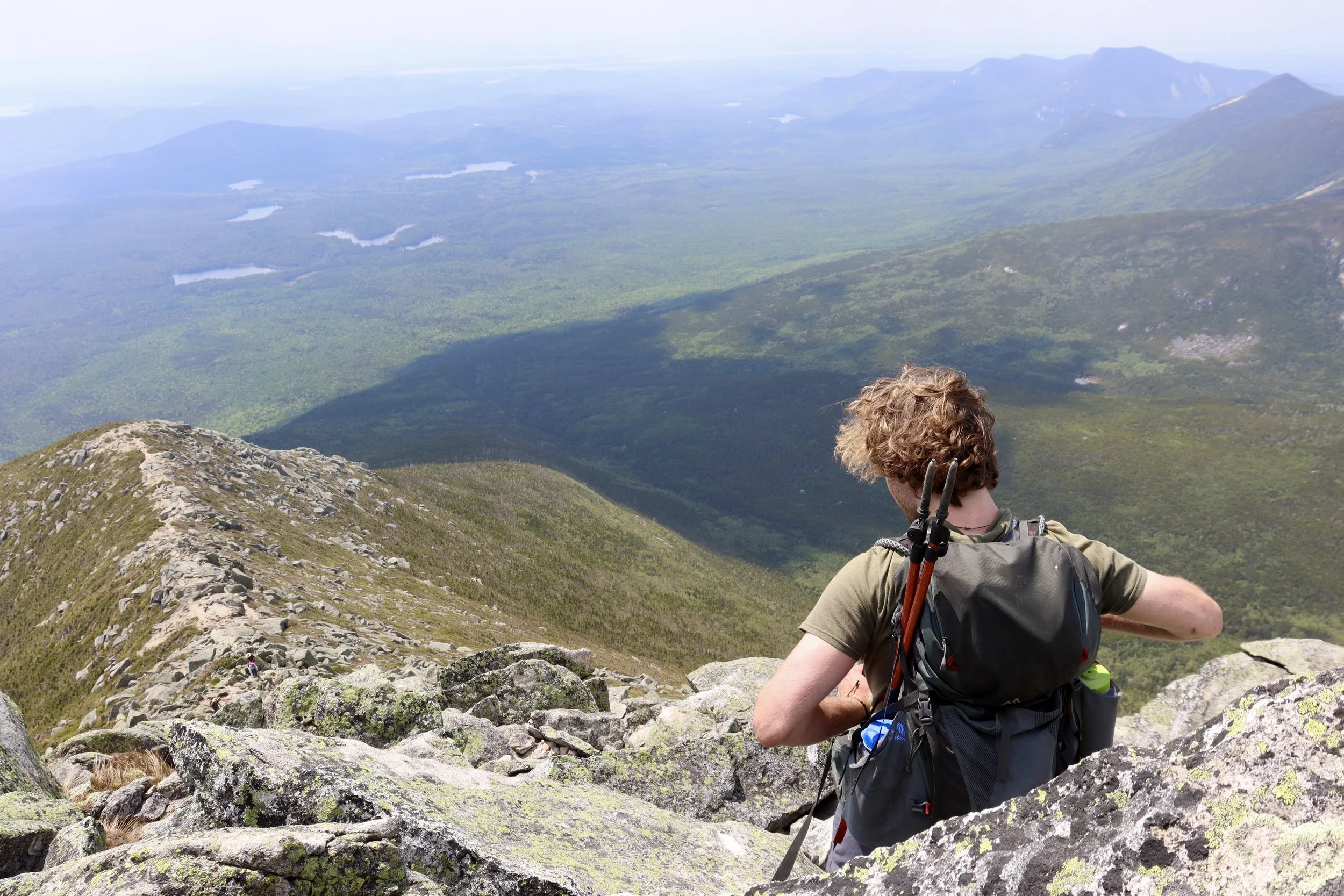
Preparing for the long climb down on Hunt.
Step 5: Reflect
“Katahdin, in all its glory…”
We Mainers are lucky that Baxter State Park even exists, and it’s only because of one exceptional man. Between 1930 and 1962, former Maine Governor Percival P. Baxter used his personal wealth to purchase and piece together what is now Baxter State Park after protective legislation for the area failed. When he died in 1969, he left behind a whopping $7,000,000 to maintain it. To this day, you won’t find electricity, running water, gas stations, stores, or paved roads in the park; it’s intentionally been left a wilderness in accordance with his wishes. What you will find are some damn beautiful peaks. Baxter wrote: "Man is born to die, his work short lived; buildings crumble, monuments decay, wealth vanishes, but Katahdin, in all its glory, shall forever remain the mountain of the people of Maine."
Get out there and climb it.
Frequently Asked Questions (FAQ)
When can you climb Katahdin?
Conditions permitting, most campgrounds in the park open for the summer season on May 15 and close either October 15 or 22. Expect pockets of snow on Katahdin before July. You can climb it in the winter, but it requires significant technical expertise, preceded by a many-mile snowmobile or cross-country ski journey, and that’s an article for another day.
What’s the best time of year to hike it?
My personal opinion is the last two weeks of September because of what I like to call the trifecta experience: stunning foliage, no bugs, and minimal crowds (most families have gone back to school). However, climbing Katahdin at any time of year is an incredible experience.
What should you bring On your Hike?
Here’s my personal checklist:
Water 💧 — two 24 oz bottles per person
Water filter 💦 — you should drink more than those 48 oz to avoid dehydration
Navigation 📶 — either download your maps onto your phone (and bring a charged portable charger), print them out, or use a GPS device. If you know how to use a compass, bring one, then teach me how to use it 😁
Headlamp 🔦 — ya never know
Knife 🔪 — a versatile tool for many problems
First aid kit 🤕— another solution to many problems
Head net for bugs 🦟 — especially before August
Insulated jacket or space blanket 🧥— weather changes quickly up there
Food 🍪 — high calorie foods like nuts, power bars, and beef jerky are great
Do you need a reservation or Permit? Does it cost anything?
No permit is required for day hikes, but permits or reservations are mandatory for overnight camping and parking at trailheads. Fees may include camping (e.g., $34/night in summer), entrance fees ($16 per vehicle for non-Maine residents), and parking (approximately $5/day). Fees vary by season and location.
Can you bring your dog?
Sadly, no. Dogs aren’t allowed in Baxter to preserve the wilderness as much as possible. Here are fantastic alternatives for hikes across Maine to do with your dog.
Which route is the best to summit Mount Katahdin?
Common routes include the Saddle Trail (longer but more gradual), the Abol Trail (shortest but very steep), and the Knife Edge loop via Helon Taylor and Saddle for a dramatic ridge traverse.
How long does it take to summit?
If you plan to do anything else in your day besides a round-trip Katahdin peak bagging, you are a brave, brave soul. A round-trip hike to the summit typically takes between 8 to 12 hours, depending on the trail chosen and your pace.
Is it kid friendly? what’s the age requirement?
Katahdin itself is not a kid-friendly summit. In fact, the official policy is very clear: children under six years old are not permitted above the treeline (timberline) on Mount Katahdin or anywhere else in the park. But Baxter State Park is a great family destination with plenty of easier hikes, wildlife viewing, and pond paddling. Chimney Pond is the classic family-friendly Katahdin hike that still feels adventurous without committing to the full mountain. Awesome alternatives in Baxter include:
Sandy Stream Pond Trail (1.5 miles round-trip) – great for spotting moose.
Daicey Pond Nature Trail (easy loop with mountain views).
Abol Pond or Kidney Pond trails (short walks with canoe rentals nearby).
OKAY, BUT REALLY, HOW HARD IS IT?
It’s objectively extremely strenuous. Yes, when I was climbing Cathedral, I did get passed by a seven-months pregnant mom and a six-year-old (let’s not talk about that), but I implore you to not underestimate these trails! The Knife Edge is a famed, narrow, knife-like ridge requiring exposure to heights and careful navigation.
What if camping at the trailheads is full?
You can camp elsewhere within the park. Here’s an interactive list of all the campgrounds in Baxter. Alternatively, Millinocket is the closest town with hotels, restaurants, and services. It’s a popular base for hikers who prefer to stay in a hotel rather than camp, and there are numerous private campgrounds in the surrounding areas.
This is an ad but we’re dead serious…😁

Is Baxter Peak the official summit? What peaks are there and which one has the sign?
Yes, Baxter Peak is the highest point and considered the official summit. It has the famous sign. Other notable peaks along the Knife Edge ridge include Pamola and South Peak.
Are there crowds? How do you avoid them?
This is a very popular experience, with good reason. Regardless of when you go, don’t let crowds impact your decision to go or not. It’s never bad enough to make it not a worthwhile experience. With that said, similar to my rec in the second question about the trifecta — aim for the window between Labor Day and October to hit a sweet spot of kids back in school (less crowds), killer fall foliage, and no bugs.
Chimney Pond? Tell me more.
Chimney Pond is a backcountry alpine pond nestled into the side of the mountain. It’s incredible, and worth the extra effort. Most commonly, you start at Roaring Brook campground, follow the mostly flat Chimney Pond Trail, ascend Katahdin up Cathedral Trail, and descend back down via Saddle. AND you can even camp at Chimney Pond, undoubtedly the most unique and mystifying camping experience for a Katahdin summit.
Looking for another adventure? You’re welcome. 😉